
GPX Generator: Making a route
A route needs at least two stops: where you start (A) and where you finish (B). You can set them by finding places by name, or by pointing at the map. Once you have both, the router works out a route between them, which you'll almost certainly want to tweak afterwards.
As an example, this page plans a ride from Abergavenny to Llandovery, which the next page then takes over the Black Mountain.
Finding a place
Press  Search, type the name of a
place, a postcode or an address, and press Search (or Enter).
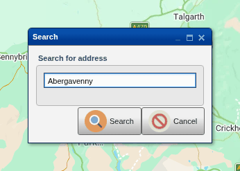
The map moves to the place and marks it with a red pin, with a menu of what you can do with it:
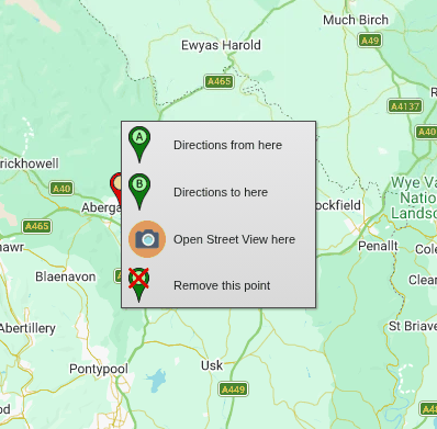
- Directions from here makes it the start of the route (A).
- Directions to here makes it the end (B).
- Open Street View here opens Google Street View there, in a new tab.
- Remove this point gets rid of the pin.
Once you have a route, the menu also has the options for adding stops described below. If you close the menu without choosing anything, tap or click the red pin to bring it back; it disappears if you click somewhere else on the map.
Pointing at the map
If you know where you want to go, find it on the map and right-click there (on a phone or tablet, press and hold):
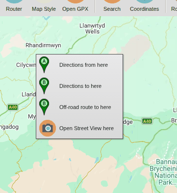
On a phone, it's the same menu, just bigger:
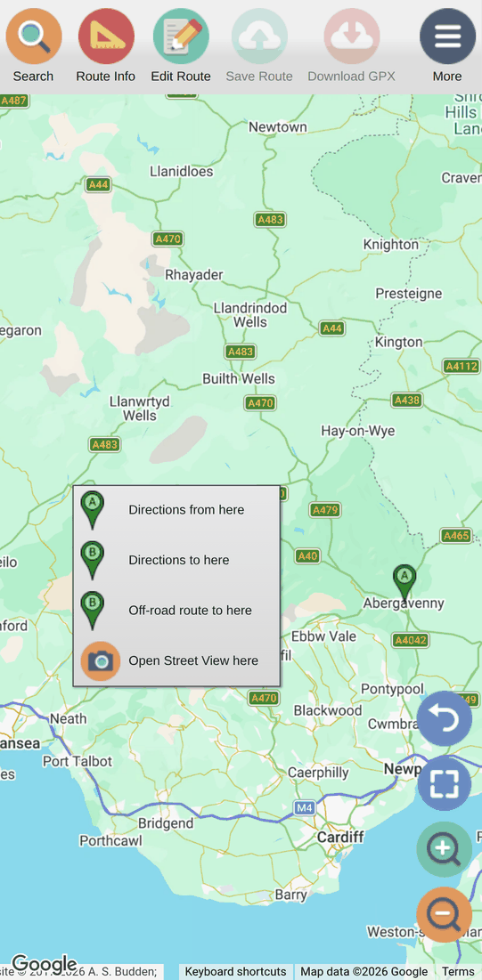
Choose Directions from here for the start, or Directions to here for the end. (Off-road route to here appears once there's a start: see Off-road legs.) As soon as there's a start and an end, the route appears:
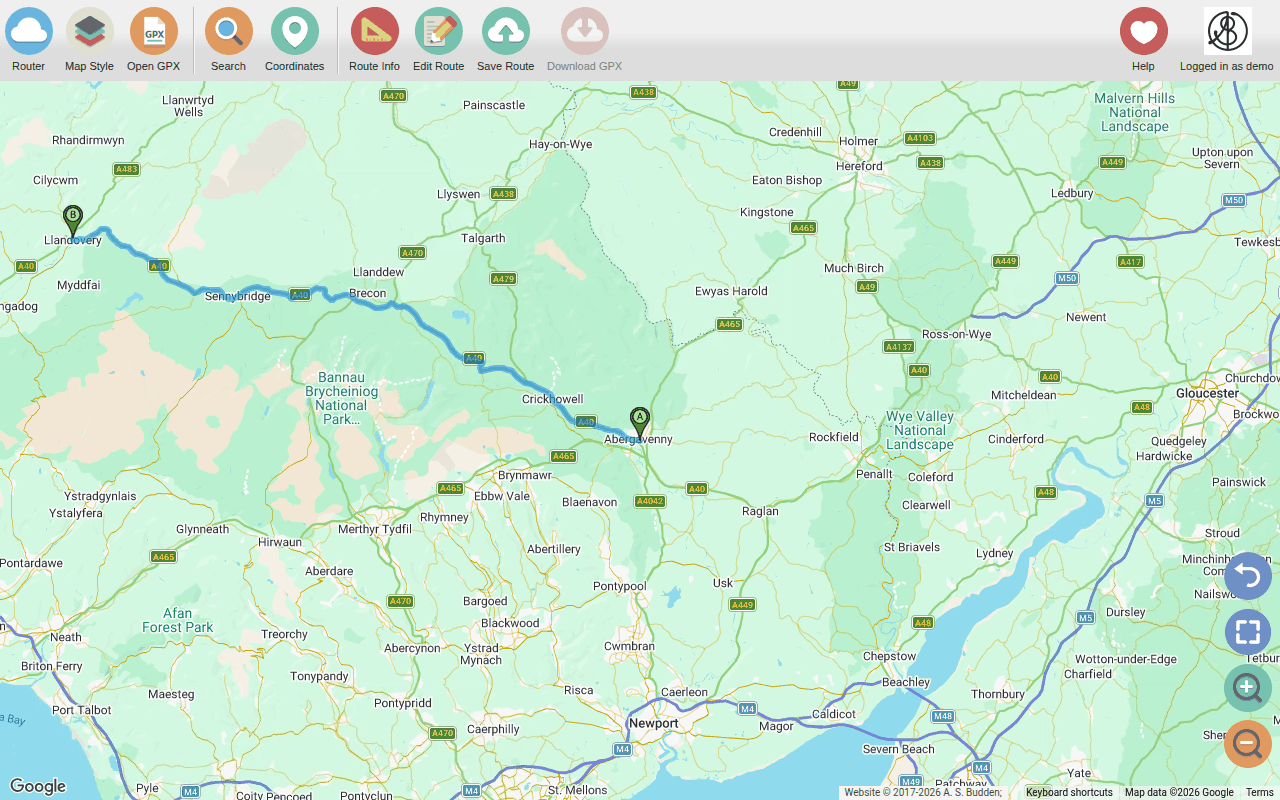
Here, Google has taken the quickest way, along the A40 through Brecon. It's a perfectly good road, but it's not why we're here: see Tweaking the route for how to change it.
Choosing Directions from here or Directions to here again moves the start or the end to the new place.
By coordinates
If you have a latitude and longitude (from a guidebook, a website or
another app), press  Coordinates, type them in and press Show on map:
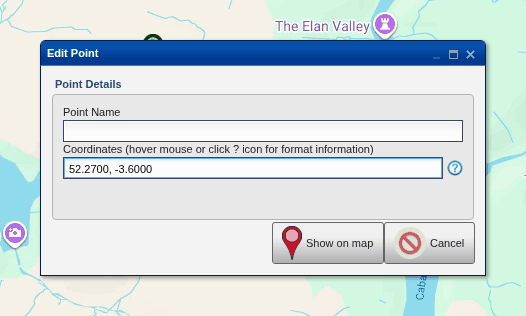
Most ways of writing coordinates are understood, for example 52.2700, -3.6000
or N52°16.200', W3°36.000'; hover the mouse over the text box (or click the
? next to the box) for the details. The place is marked with a red pin and
the same menu as a search result.
More than two stops
Most rides have more than one leg: a stop for coffee, fuel or lunch, or a point you want to be sure of passing. Once you have a route, the map's menu has more options:
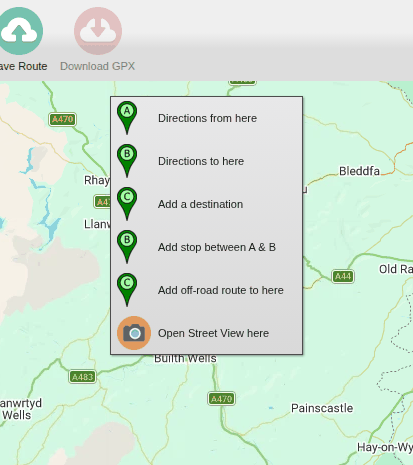
- Add a destination adds a new stop at the end of the route, so the old end becomes a stop on the way.
- Add stop between A & B (or, once there are several legs, Add stop between..., then which two) adds a stop in the middle of the route, between the stops you choose.
Here, a second leg on to Rhayader has been added with Add a destination:
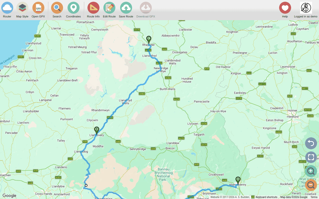
You can also add a stop exactly on the route by right-clicking (or long-pressing) on the route itself: see Stops on the route.
A route can have up to ten legs. For a longer trip, plan a route for each day (or each part of the day).
Starting again
Edit Route >  Clear Route
removes everything from the map, so you can start a new route. (If you
didn't mean to,
 Undo brings it back.)
To plan the same ride the other way round,
Edit Route >  Reverse swaps the
start and the end (and everything in between).
This website is free and ad-free, but costs me money to run. If you'd like to support this site, please consider making a small donation or sending me a message to let me know what you liked or found useful.