
GPX Generator: Maps and settings
Map styles
 Map Style chooses the map you plan
on. It doesn't change how the route is worked out (that's the
router), only what you see underneath it, so pick whichever
makes the roads you're interested in easiest to see.
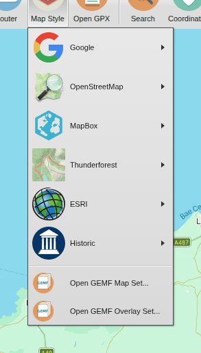
The maps come in groups: Google's, OpenStreetMap, Mapbox, Thunderforest, ESRI (a topographic map and a shaded-relief map) and historic maps (from the National Library of Scotland). (Google's maps are only there with the Google router; with the Mapbox router, the map starts with a Mapbox style.)
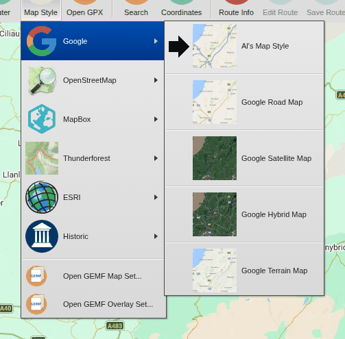
The default, Al's Map Style, is Google's map restyled to make the smaller roads (the interesting ones) easier to see, and to give motorways their proper colour. Google's own styles are there too, including satellite pictures and terrain.
GEMF map files
On a computer (not on a phone), you can also plan on a map stored in a
GEMF file on your computer, such as one made with
Mobile Atlas Creator for an offline phone
app. Choose  Open GEMF Map Set... and pick the file, or Open GEMF
Overlay Set... to draw it on top of another map (for example a map of
just the contours, or of tracks). Open overlays are listed under
 Overlays on the Map Style menu:
choose one there to take it off the map, and again to put it back.
Your browser may ask for permission to read the file. Once opened, a GEMF map stays on the Map Style menu (Reopen GEMF Set) so you can open it again next time without looking for the file; Remove Custom Map forgets it.
User preferences
Click Logged in as ... in the top right-hand corner, then
 User preferences. The
settings are on four tabs. Press Save to keep your changes.
Main
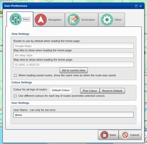
- Router to use by default and Map tiles to show when you open the site.
- Map view to show when loading the home-page: where the map starts. It starts with the UK in view; move the map to where you usually ride and press Set to current view.
- When loading saved routes, show the same view as when the route was saved: otherwise the map zooms to fit the route.
- Colour for all legs of routes, or different colours for each leg, which makes it easier to see where each leg starts and ends.
- User Name: needed for named addresses for your routes. It can only be set once, so choose carefully.
Navigation
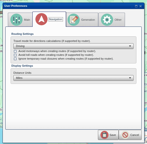
- Travel mode: driving (which is what you want on a motorbike), cycling or walking, where the router supports them.
- Avoid motorways, avoid toll roads and ignore temporary road closures, where the router supports them.
- Distance Units: miles or kilometres.
These are used for new legs; legs already on the map keep the options they were planned with.
Generation
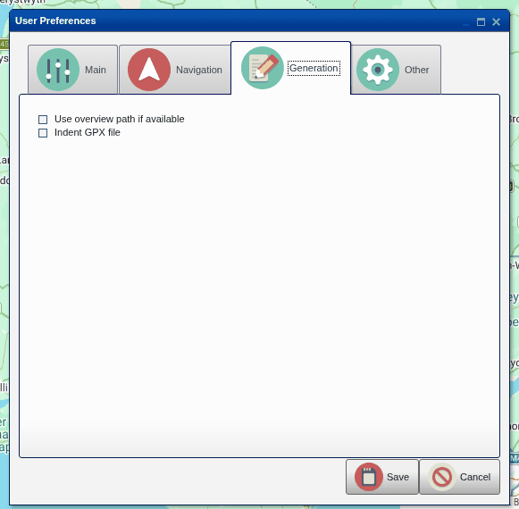
How the GPX files are written:
- Use overview path if available: with the Google router, describe the road with fewer points. The files are smaller, for sat navs that struggle with big files, but follow the road less exactly.
- Indent GPX file: lay the file out so it's easier for a person to read. Sat navs don't mind either way.
Other
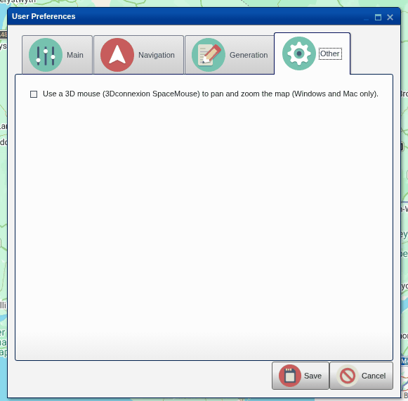
- Use a 3D mouse: pan and zoom the map with a 3Dconnexion SpaceMouse (on Windows and Mac computers, with 3Dconnexion's driver installed). See Help > 3D mouse (SpaceMouse) support.
Help
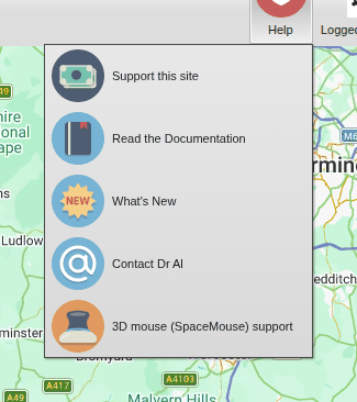
 Support this site: the
site is free, but costs money to run. Donations are very welcome.
 Read
the Documentation: this guide.
 What's New: what's changed
recently (see What's new).
 Contact Dr Al: to report a
problem, ask a question or suggest something.
 3D mouse (SpaceMouse) support:
whether a 3D mouse can be used, and how to turn it on.
This website is free and ad-free, but costs me money to run. If you'd like to support this site, please consider making a small donation or sending me a message to let me know what you liked or found useful.